Introduction
Navigating through the wilderness can be an exciting and rewarding experience, but it also presents challenges that require tools and resources to overcome.
Modern technology offers a wide range of navigation devices designed to aid explorers in finding their way effectively. This article will delve into
essential navigation technologies, such as GPS, compasses, and mapping software, and provide examples of popular devices and techniques for using them to
navigate successfully.
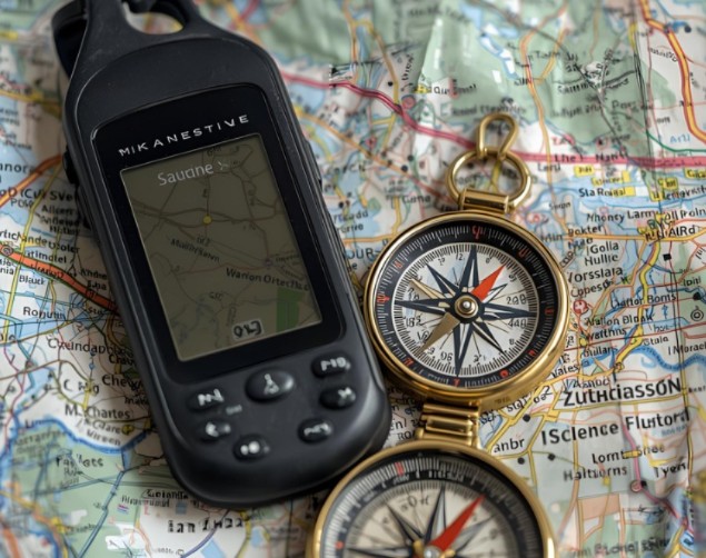
GPS (Global Positioning System)
Portable GPS Devices
Portable GPS devices are compact handheld devices that provide accurate location information, maps, and navigation instructions. These devices use satellite
signals to determine your position on Earth and can be useful for hiking, camping, or boating trips. Popular portable GPS devices include the Garmin eTrex
series, Magellan Explorist series, and DeLorme inReach SE.
Smartphone Apps
Smartphones equipped with GPS capabilities offer a convenient way to navigate while outdoors. Various apps can be used for mapping, navigation, and tracking
your route. Some popular navigation apps include Gaia GPS, AllTrails, and MapMyHike. These apps often allow you to download maps for offline use, set
waypoints, and follow predefined trails or routes.
Compasses
Traditional Compasses
Traditional compasses are essential navigation tools that indicate direction based on magnetic north. A basic compass consists of a magnetized needle
suspended over a dial marked with cardinal directions (North, South, East, and West). More advanced models may include features such as declination
correction, sighting mirrors, or electronic displays for improved accuracy.
Smartphone Compass Apps
Smartphones can also function as compasses using specialized apps. These apps use the device’s built-in GPS and magnetometer to display your heading (the
direction you are facing) on a digital compass dial. Examples of smartphone compass apps include Compass 360, Smart Compass, and Digital Compass Pro.
Mapping Software
Online Mapping Services
Online mapping services like Google Maps, Bing Maps, or OpenStreetMap provide satellite imagery, street maps, and topographic data for various regions of
the world. These resources can be useful for planning trips, researching potential routes, and finding landmarks or points of interest. You can access these
services from your computer, smartphone, or tablet with an internet connection.
Offline Mapping Apps
Offline mapping apps allow you to download maps for offline use, making them ideal for navigation in areas without cell service or satellite coverage.
Examples of popular offline mapping apps include Gaia GPS and OSMand+. These apps often offer features like route planning, waypoint creation, and trail
tracking.
Conclusion
Navigating through the wilderness using technology can greatly enhance your experience by providing accurate location information, maps, and navigation
instructions. By familiarizing yourself with various navigation technologies such as GPS, compasses, and mapping software, you can improve your ability to
navigate effectively and explore the outdoors confidently. Always remember that proper preparation is key, so carry backup devices, batteries, and maps when
possible, and practice using these technologies regularly to ensure your safety and enjoyment in the wilderness.